Conducting a hydrogeological survey in volcanic terrain involves a series of steps to understand the groundwater resources, their quality, and their movement within the geological context. Here’s a detailed process:
- Preliminary Study and Planning
- Literature Review:
- Collect existing geological maps, hydrogeological reports, and remote sensing data of the area.
- Review previous studies, hydrological data, and climate information.
- Objective Definition:
- Define the objectives of the survey, such as identifying groundwater potential zones, assessing water quality, or understanding aquifer characteristics.
- Planning:
- Design the survey methodology considering the specific challenges of volcanic terrain.
- Plan logistics, including team composition, equipment needs, and survey schedule.
- Field Reconnaissance
- Site Visits:
- Conduct initial visits to understand the terrain, accessibility, and local conditions.
- Identify key geological features such as lava flows, pyroclastic deposits, volcanic cones, and fractures.
- Stakeholder Engagement:
- Engage with local communities and stakeholders to gather indigenous knowledge and gain access to private lands.
- Geological and Geophysical Surveys
- Geological Mapping:
- Map surface geology to identify different volcanic units, their extents, and their relationships.
- Identify geological structures such as faults, fractures, and lineaments that may influence groundwater flow.
- Geophysical Methods:
- Electrical Resistivity Tomography (ERT): Map subsurface resistivity variations to identify aquifers and their properties.
- Magnetotellurics (MT): Used for deeper subsurface investigations.
- Seismic Refraction: To delineate subsurface layering and identify aquifer depths.
- Ground Penetrating Radar (GPR): For shallow investigations and mapping near-surface features.
- Hydrogeological Investigations
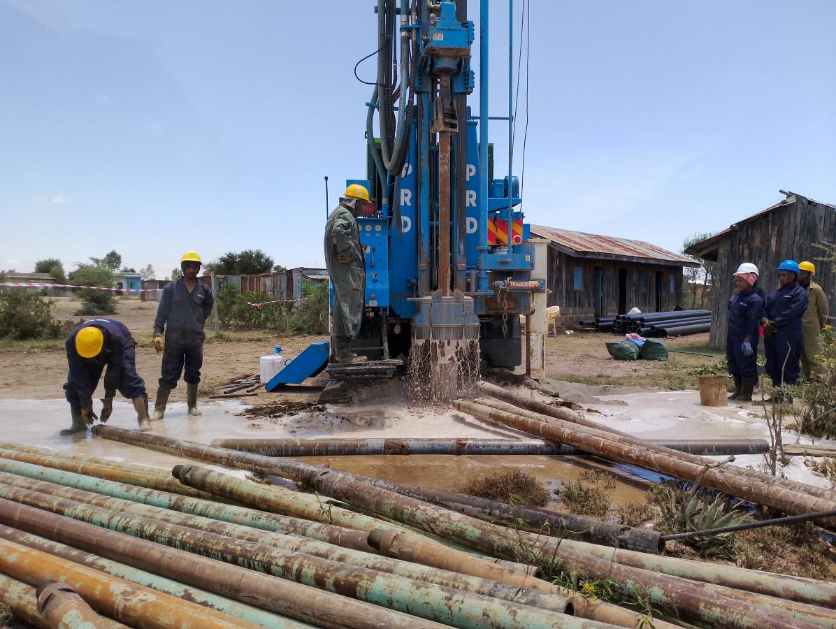
- Drilling and Borehole Logging:
- Drill exploratory boreholes to obtain core samples and log lithological data.
- Conduct borehole geophysical logging to assess aquifer properties.
- Aquifer Testing:
- Perform pumping tests to determine aquifer parameters such as transmissivity, storativity, and hydraulic conductivity.
- Use slug tests in boreholes for preliminary hydraulic conductivity estimates.
- Water Sampling and Analysis:
- Collect groundwater samples from wells and boreholes for chemical analysis.
- Test for parameters such as pH, electrical conductivity, major ions, trace elements, and isotopic composition.
- Data Integration and Analysis
- Data Compilation:
- Compile geological, geophysical, and hydrogeological data.
- Create cross-sections and 3D models to visualize subsurface conditions.
- Hydrogeological Modeling:
- Develop conceptual and numerical groundwater models to simulate groundwater flow and recharge.
- Calibrate models using field data and validate with additional observations.
- Water Quality Assessment:
- Analyze water quality data to assess potability and identify any contamination sources.
- Study the hydrochemical evolution of groundwater in the volcanic terrain.
- Reporting and Recommendations
- Report Preparation:
- Prepare a comprehensive report detailing methodologies, findings, interpretations, and conclusions.
- Include maps, cross-sections, and models to illustrate results.
- Recommendations:
- Provide recommendations for groundwater management, potential extraction sites, and monitoring strategies.
- Suggest further studies or monitoring programs if necessary.
- Stakeholder Presentation:
- Present findings to stakeholders, including local authorities, communities, and environmental agencies.
- Provide actionable insights and guidance based on the survey results.
Challenges and Considerations
- Complex Geology: Volcanic terrains often have complex and heterogeneous geology, requiring detailed and careful investigation.
- Accessibility: Rugged terrain and volcanic features can pose logistical challenges.
- Environmental Sensitivity: Volcanic areas can be ecologically sensitive, requiring environmentally responsible survey practices.
- Data Integration: Integrating diverse data types (geological, geophysical, hydrogeological) for a coherent interpretation can be challenging but is essential for accurate results.
By following this structured process, hydrogeologists can effectively study and understand the groundwater systems in volcanic terrains, leading to sustainable management and utilization of groundwater resources.