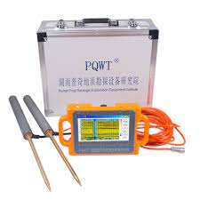
Using a PQWT (Portable Quick Well Tester) in the field involves several steps to conduct groundwater exploration and determine the depth and yield of water wells. Here’s a general guide on how to use a PQWT in the field:
- Preparation:
- Familiarize yourself with the PQWT device, including its components, controls, and operating procedures.
- Ensure that the PQWT is fully charged or powered by suitable batteries before heading to the field.
- Prepare any additional equipment needed for the survey, such as measuring tape, markers, and protective gear.
- Site Selection:
- Choose the survey area based on the objectives of the groundwater exploration, such as identifying potential well locations or assessing existing wells.
- Consider factors such as geological formations, hydrological conditions, and accessibility when selecting survey sites.
- Survey Setup:
- Set up the PQWT device on a stable surface at the survey location, ensuring it is level and securely positioned.
- Connect any necessary cables or probes to the PQWT according to the manufacturer’s instructions.
- Turn on the PQWT device and allow it to initialize, following the startup procedures outlined in the user manual.
- Measurement Procedure:
- Select the measurement mode or program on the PQWT device based on the survey objectives and site conditions (e.g., well depth estimation, water yield assessment).
- Follow the on-screen prompts or instructions provided by the PQWT device to initiate the measurement process.
- Use the PQWT probe or sensor to conduct measurements at designated points, such as potential well locations or existing wells.
- Record the measurement data, including depth readings, water yield estimates, and any other relevant information provided by the PQWT device.
- Data Interpretation:
- Interpret the measurement data collected by the PQWT device to assess groundwater conditions and potential well sites.
- Analyze depth readings to determine the depth to water table or potential well depth at each survey location.
- Evaluate water yield estimates to estimate the potential yield of groundwater wells and assess groundwater availability.
- Site Marking:
- Mark potential well locations or existing wells based on the results of the PQWT survey, using markers or flags to indicate the precise locations.
- Record the GPS coordinates or other location information for each marked site to facilitate future reference and follow-up.
- Documentation:
- Document the results of the PQWT survey, including measurement data, site observations, and any additional notes or comments.
- Create a field report summarizing the survey findings, recommendations for well drilling or development, and any other relevant information.
- Post-Survey Maintenance:
- Clean and inspect the PQWT device and accessories after use to ensure proper functioning and prevent damage or corrosion.
- Store the PQWT device and accessories in a dry, secure location, following the manufacturer’s recommendations for maintenance and storage.
By following these steps, you can effectively use a PQWT in the field to conduct groundwater exploration, assess potential well sites, and estimate water yield for well drilling and development projects.